Malton Town
Where is/was that Street?
Over the years and as the town has developed, streets have appeared, disappeared and even been renamed. In Malton Streets the occurrence of the streets and yards through the various censuses, together with the locations of the less obvious ones is shown. It is hoped that this table will help those unfamiliar with the town and also begin to show when streets and yards appeared or disappeared.
The History of Houses and Other Buildings in Malton
There are over 200 listed buildings in Malton and a list of these can be seen at the Historic England Archive. You should expect to see the approximate date of construction and any important architectural features. Most entries also have a recent photograph. If you want to see who lived in the property then you will need to consult the censuses. Be aware that the numbering of houses in the streets is a relatively new concept in Malton and matching physical properties to 19th century census information is not a straightforward task and some level of 'reconstruction' may be necessary. It may be possible to clarify who occupied business or residential premises by using trade directory infromation. The name of the occupier is the key link into the North Riding Register of Deeds - see below.
Malton Buildings Group have taken a special interest in the architecture and renovation of a number of buildings in Malton and the immediate surrounding area. This extends to securing plans, photographs and architectural reports and information about the materials used in the original construction and their sources. The particular building in which you are interested may not be covered but it is likely you will learn all about the 'architectural context' of the town
Another source for tracing the history of buildings in Malton is the North Riding Register of Deeds. The North Riding County Record Office (NRCRO) has over a million deeds for the period 1736 to 1930 all of which are indexed. It was common practice to copy deeds and have them recorded in the deeds registry. A research team led by Dr Joan Heggie of Teesside University has built a searchable database of the indexes for the years 1784-1790 and 1885-1889. In both cases, you will need the volume, page and number from the index to obtain the deed at the NRCRO. Once you have the deed you may be lucky and be able to see a description of the property and a plan but in many cases you will only see abstracts (memorials).
Parish Boundaries
In 1855 following the demise of Rev. Jno. Walker the then vicar of Slingsby, the Rev. W. Carter, the then incumbent of the united parishes of St. Michael’s, St. Leonard’s and St. Mary’s, was granted the living at Slingsby. This required him to resign the living of the united parishes. This gave the opportunity for diving the parish into three portions, each then being a distinct incumbency with its own parish church. The boundaries of the parishes were confirmed by an order in council dated 19th October 1855:
Old Malton – bounded on the west by the township of Broughton; on the north, partly by the township of Ryton, and partly by that of Pickering Marishes; on the north-east by the parish of Rillington; east and south-east by the parishes of Settrington and Norton; and south west by a line passing along the middle of the Malton and Thirsk line of railway.
St. Leonard’s – bounded on the north-east by the aforesaid supposed line; on the west by the parish of Broughton; on the west and south-west by the boundary line passing (in the centre of streets) down Newbegin and Wheelgate, and then to the south to the River Derwent, which is the boundary on the south.
St. Michael’s – to consist of the remaining land lying within the last named boundary line, extending to the parishes of Huttons Ambo and Broughton. By this alteration, the pasroonage was transferred from the parish of Old Malton to that of St. Michael’s.
Yorkshire Gazette, 15 November 1856
Historic Maps
The Ordnance Survey is a Government department founded in 1791. Mapping commenced in the south-east of England to support military purposes - at that time the threat of French invasion. An exercise to map the whole of England was started in the 19th century and maps of 6 inches to a mile and 25 inches to a mile were produced. The country was divided into a grid with sheet numbers corresponding to the 6" to 1 mile scale maps. Each 6" to 1 mile scale map was then divided into sixteen maps at a scale of 25" to 1 mile. New Malton can be found on sheet 124 of the larger scale map series. The centre of the town can be found on sheet 124.6. The latter map shows individual plots/properties and is available for 1890, 1910 and 1927 - these are approximate years and not necessarily the year of the survey. These maps have been digitised by tand can be viewed online at East Riding of Yorkshire Archive Service . The latter edition can also be purchased from Alan Godfrey Maps at a modest price.
The North Yorkshire County Record Office has a small collection of maps, as shown in their catalogue:
- 1770 Plan of Malton 43" x 20" scale 12 chains: 1" ref: ZPB M 1/1
- 1801 Plan of Borough of Malton 38" x 31" scale 8 chains : 1" ref: ZPB M 1/3
- 1801 Plan of Malton 23" x 16" no scale given ref: ZPB M 1/4
- 1809 Plan of Malton by Ralph Burton 55" x 41" no scale given ref: ZPB M 1/6
- 1826 Malton Market Place Sketch of buildings etc. to be taken down for the new Market Place 26" x 21" ref: ZPB M 1/9
- 1844 Plan of town 38" x 28" scale 2 chains : 1" ref: ZPB M 1/12
- 1853 Malton Town Consists of 1853 OS sheets 50" x 38" scale 1 mile: 5' ref: ZPB M 1/17
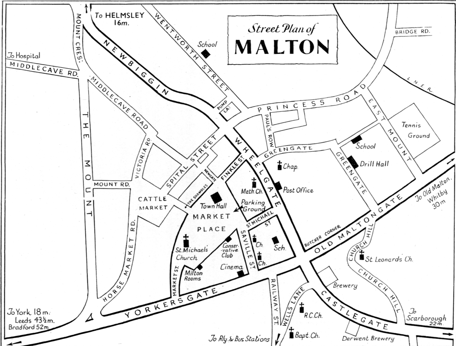
Mid 20th Century Map
This is a mid 20th Century town plan showing all the main streets.

House Numbering
House Numbering in Malton was under discussion by the Local Board in July 1891 [1] as a letter had been received from Earl Fitzwilliam's steward who wrote that "he did not consider it necessary, considering the size of the town, and it would be objectionable in many ways." The Local Traders' Association had passed a resolution approving of the scheme. Kelly's 1893 Directory of Yorkshire North & East Ridings does give numbers in most streets. The 1901 Census included house numbers. We have not found a reference as to when numbering was brought in and our earliest dated sighting is an announcement in November 1893 [2] of the death of William Lightowler, on the 24th inst., at 5, Wheelgate, Malton.
- [1] Yorkshire Gazette, 1 August 1891
- [2] York Herald, 27 November 1893
Some Old Views of Malton
18th Century View
Possibly one of the earliest known pictures, an 18th Century view of Malton from the river engraved by Samuel Middiman.

At The Time Of The 1867 Floods
The Illustrated London News dated 9th February 1867 carried an article 'The Great Floods in Yorkshire' accompanied by this engraving 'the view at Malton'

Malton From The River
Engraved by Walker & Storer, drawn by F Nicholson, published 1794 by Harrison of Paternoster Road, London

What was the Town Like in 1854?
One can begin to build a picture of what Malton was like in the 1850s by reading the report of the General Board of Health regarding the Sanitary Condition of Malton, written in 1854 [1]. What follows is based on our reading of that report. In 1851 the population of Malton was 7,661 and there were 1,545 houses, so around 5 people in each house. This was just an average, browse the transcript of the 1851 census to see how much this could vary. A quarter of the deaths were caused by 'zymotic diseases' (fevers and contagious diseases (e.g. typhus and typhoid fevers, smallpox, scarlet fever, measles, whooping cough, cholera, diphtheria etc.) Medical opinion considered the incidence of fever was due to stagnant refuse near and within houses, and to the general filthy state of streets, lanes, courts and yards which were without proper sewers and drains. The larger portion of the population lived in small houses, having no drainage, and imperfect means of ventilation. The water supply was from pumps and wells, carried to the place of use, and which was often stored in open vessels in living rooms where it became 'tainted by absorbing gases of decomposition.' In parts the town was overcrowded. There were courts of cottages, entered by covered passages, in which privies, cesspools, and pigsties have been improperly placed. Some old houses are thatched; the greatest number are covered with red tiles; a few of the newer houses are slated. Most of the old homes are built of wall stone limewashed externally. The living rooms are small and low; the bedrooms are very low, the roofs spring from the side walls some three feet above the floor. Many rooms are let off in separate tenements. The streets are partially formed of broken stone, with paved channels; some are boulder-paved, refuse and slop water drainage from the courts and houses flowing on to the streets, and over the surface. Large ash-middens, privies, and cesspools are crowded amidst dwelling-houses, beneath room windows, and even underneath sleeping rooms. Rent for houses of two rooms range from £3 to £4 and 2s3d a quarter rates.
- [1] York Herald, 15 July 1854
Planning & Building Control
Possibly the first attempts at improving the planning of the streets and buildings therein were made by the Malton Local Board of Health in May 1855, signified by two announcements in the local newspapers.
THE BOARD HEREBY GIVE NOTICE, that the Provisions of the new "Public Health Act, 1848," with respect to all NEW STREETS will be strictly enforced. By Section 72 it is enacted, "That one Month at least before any Street is newly laid out as aforesaid, written notice shall be given to the Local Board of Health, showing the intended Level and Width thereof; and the Level and Width of every such street shall be fixed by the said Local Board. And it shall not be lawful to lay out, make or build upon any such Street, otherwise than in accordance with the Level and Width so fixed. And whosoever shall lay out, make, or build upon any such Street otherwise than in accordance with the Level and Width fixed by the said Local Board, shall be liable to a Penalty not exceeding £20 for every day during which he shall permit or suffer such Street to continue to be improperly laid out, made, or built upon." Any Street laid out otherwise than in accordance with the Level and Width so fixed, or any Building built in any such Street otherwise than in accordance with such Level and Width, is to be altered in such manner as the case may require; and the expenses incurred by the Local Board in so doing shall be repaid by the Offender. By order, Samuel Walker, Clerk Malton, 3rd May, 1855
THE BOARD HEREBY GIVE NOTICE, that the Provisions of the "Public Health Act, 1848," and the "Towns Improvement Clauses Act, 1847," now in force within the Borough, with regard to Building and Rebuilding, to be strictly complied with. By Section 53, of the first-mentioned Act, it is enacted, “That fourteen days at the least before beginning to dig or lay out of the Foundations of or for any New House, or to rebuild any House pulled down to the extent aforesaid, the Person intending so to build or rebuild shall give to the Local Board of Health written notice thereof, together with the Level or intended Level of the Cellars or lowest Floor, and the situation or construction of the Privies and Cesspools to be built, constructed or used in connection with such House. And it shall not be lawful to begin to build or rebuild any such House, or to build or construct any such Privy or Cesspool, until the particulars so required to be stated have been approved by the said Local Board. And in default of such Notice, or if any such House, Privy, or Cesspool be built, rebuilt, or constructed as aforesaid, without such approval, or in any respect contrary to the Provisions of the Act. The Offenders shall be liable to a penalty of not exceeding £50. And the said Local Board may, if they shall think fit, cause such House, Privy, or Cesspool to be altered, pulled down, or otherwise dealt with as the case may require, and the expenses incurred by them in so doing shall be repaid by the Offender."
Further information may be obtained on application to the Clerk By order, Samuel Walker Malton, 3rd May, 1855 Clerk to the Board
Town Guides
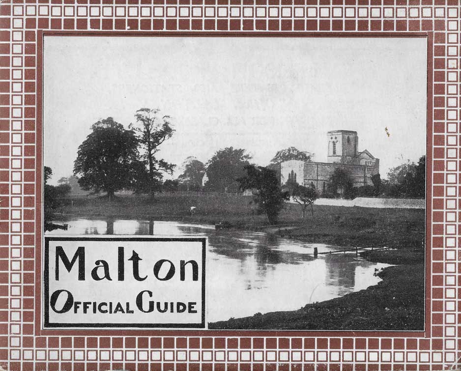
Town guides have traditionally given the Council, and Malton, Norton and District Chamber of Trade an opportunity to publicise the virtues of the town to visitors and newcomers. Tradesmen also get an opportunity to advertise. Typical content is a brief history of Malton, photographs of the main thoroughfares, a map, places of worship and education, together with accommodation and ideas for exploring the surrounding area.
Click on the images to open each guide.
(Given that a number of these Guides are not dated, some informed guesswork has been used in estimating publication dates. A further clue to dates might be in the list of councillors appearing in each guide. This clue will be pursued and if necessary estimated dates will be revised.)
1921/24
We cannot place an exact date on this guide. There are however, a few clues as population figures as counted in the 1921 census are quoted. The best clue is at the bottom of page 19 where it states 'at the time of compiling this guide, the Glasgow United Foundry are establishing works ... ...' The Yorkshire Post and Leeds Intelligencer, dated 26 October 1921 refers to the planning of this and a meeting of the Malton & Norton Urban Council. The digital copy of this guide was kindly provided by Tim Wheater.

1939/40?
This guide is not dated. It is post 1931 as it quotes the population from the 1931 census. Mrs Forsyth has an advertisement and it is known that she opened her shop in 1931 and that she died in 1945. This guide also refers to the lighting contract for the town being returned to the Gas Company in 1933. This is presumably the first guide, referred to in the 1953/54 guide. (Note there are no pages numbered 5 and 6 in the original of this guide.)

1948/49
This guide is not dated but the reference in this guide on page 25 under 'Dates to Remember' the Great Yorkshire Show being in July 1949, is presumably prospective!

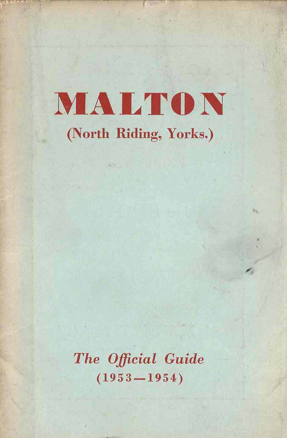
1953/54
'Thirteen years have elapsed since the first edition of this booklet was issued …' says the introduction to what must be the second edition of Malton - The Official Guide (1953-54)] 'In that period the characteristics of Malton have not altered to any great degree. Most noticeable, perhaps, are the comparatively new houses and flats erected by the Council under the provisions of various Housing Acts.'

1957/58?
I have not been able to precisely date this guide. However it does contain some clues! Page 13 refers to a 'Grant of Arms' assigned to Malton Council by the College of Arms in October 1957. On page 18 there is a reference to the new Secondary School 'incourse of erection, and due to be opened in September 1958.' It appears likely therefore that this guide is for the period 1957/58.

1959/60?
This guide has a near identical cover to the previous one and the advertisements are similar. Page 21 refers to the Malton Secondary School having been completed in 1958. Also that work is due to start on a new Junior School and a new Roman Catholic School in 1961. I cannot establish an exact date for this guide, but the Blanchard family believe that Mrs Ethel Blanchard was landlady of the Gate Inn at some period between 1959 and 1963 - see the advertisement on page 34. This all suggests that this guide is for the period 1959/60

1967/68
This guide is dated 1967/68, see the bottom of page 9.

1972?
Again, this guide is not dated and it is difficult to exactly put a date to it. However, the Castle Hotel advertisement on page 2 says 'B&B from £1.60' so this must have been published post decimalisation ie 1971 or later. Editorial on page 19 promises "A By-pass road round Malton and Norton is planned to commence in 1974 and to be completed in 1976' I take a guess that this guide was published in 1972.

Found Something Useful?
If you've found something useful or interesting please consider making a donation to The Woodhams Stone Collection. The Woodhams Stone Collection is entirely run by volunteers and is housed in the Malton & Norton Heritage Centre. A donation, however small, would help towards our running costs and the purchase of archive quality materials required to store and preserve the Collection for future generations. If you should decide to donate via the PayPal button neither you nor The Woodhams Stone Collection will be charged a fee for processing this donation.
At the end of the transaction you will be asked if you wish the payment to be made as part of the GiftAid scheme. If you are a UK taxpayer and able to do this it means that Woodhams Stone Collection can benefit by an additional 25% of your donation.
